Enhance Your
Outdoor Experience
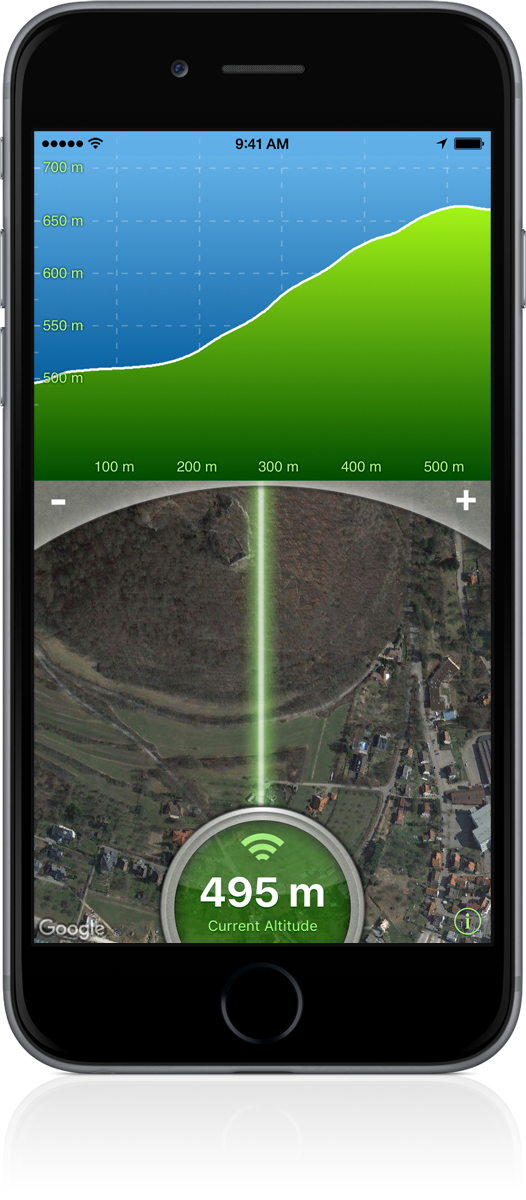
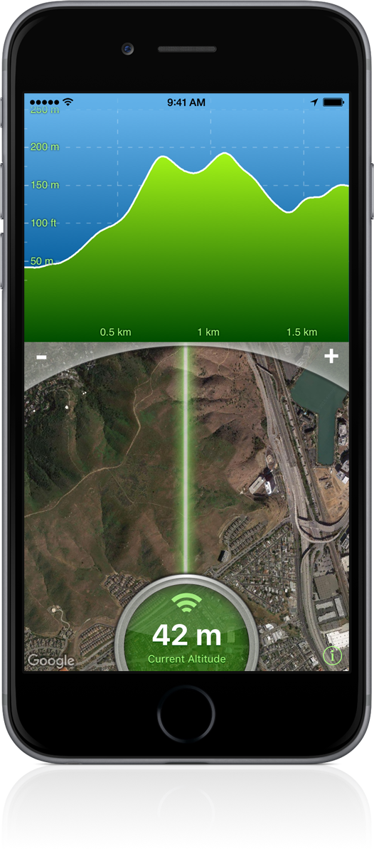
With this altimeter app you can analyze the terrain around you. Discover the height of the hill in front of you or take a look at further away mountains.
Point your Smartphone into any direction and instantly obtain a detailed elevation chart.
The altitudes are calculated through online services, based on your GPS position and compass direction.
Adjustable
Operating Distance
Look ahead and explore the terrain in front of you.
Use the +/- buttons to set an operating range between 500 m and 5000 m (1700 ft - 17000 ft).
Meter and feet are supported.
High-Resolution Elevation Data
Terrain Radar uses the ASTER Global Digital Elevation Model with a ground resolution of 30 meter. ASTER GDEM is a product of METI and NASA.
The dataset covers 99 percent of the Earth’s land mass.
